| Name | |
|---|---|

Alaska: Denali
63.069, -151.008
|
|

California: Mount Whitney
36.579, -118.292
|
|

Colorado: Mount Elbert
39.118, -106.445
|
|

Washington: Mount Rainier
46.853, -121.76
|
|
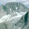
Wyoming: Gannett Peak
43.184, -109.654
|
|
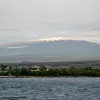
Hawaii: Mauna Kea
19.821, -155.468
|
|

Utah: Kings Peak
40.776, -110.373
|
|
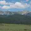
New Mexico: Wheeler Peak
36.557, -105.417
|
|
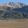
Nevada: Boundary Peak
37.846, -118.351
|
|

Montana: Granite Peak
45.163, -109.808
|
|

Idaho: Borah Peak
44.138, -113.781
|
|
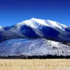
Arizona: Humphreys Peak
35.346, -111.678
|
|

Oregon: Mount Hood
45.374, -121.696
|
|
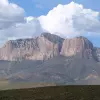
Texas: Guadalupe Peak
31.891, -104.861
|
|

South Dakota: Black Elk Peak
43.866, -103.533
|
|

North Carolina: Mount Mitchell
35.765, -82.265
|
|

Tennessee: Clingmans Dome
35.563, -83.499
|
|

New Hampshire: Mount Washington
44.271, -71.303
|
|

Virginia: Mount Rogers
36.66, -81.544
|
|

Nebraska: Panorama Point
41.011, -104.03
|
|

New York: Mount Marcy
44.113, -73.924
|
|
Maine: Mount Katahdin
45.904, -68.921
|
|
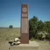
Oklahoma: Black Mesa
36.932, -102.998
|
|

West Virginia: Spruce Knob
38.7, -79.533
|
|

Georgia: Brasstown Bald
34.874, -83.811
|
|

Vermont: Mount Mansfield
44.544, -72.814
|
|
-thumb-square.webp)
Puerto Rico: Cerro de Punta
18.173, -66.592
|
|
-thumb-square.webp)
Kentucky: Black Mountain
36.914, -82.894
|
|

Kansas: Mount Sunflower
39.022, -102.037
|
|

South Carolina: Sassafras Mountain
35.065, -82.777
|
|

North Dakota: White Butte
46.387, -103.303
|
|

Massachusetts: Mount Greylock
42.637, -73.166
|
|

Maryland: Hoye-Crest
39.237, -79.485
|
|

Pennsylvania: Mount Davis
39.786, -79.176
|
|
|
American Samoa: Lata Mountain on Ta‘ū island
-14.237, -169.457
|
|

Northern Mariana Islands: Mount Agrihan
18.767, 145.667
|
|

Arkansas: Mount Magazine
35.167, -93.645
|
|

Alabama: Cheaha Mountain
33.486, -85.809
|
|
|
Connecticut: Massachusetts border on southern slope of Mount Frissell
42.05, -73.483
|
|

Minnesota: Eagle Mountain
47.898, -90.56
|
|

Michigan: Mount Arvon
46.756, -88.156
|
|

Wisconsin: Timms Hill
45.451, -90.195
|
|

New Jersey: High Point
41.321, -74.662
|
|

Missouri: Taum Sauk Mountain
37.57, -90.728
|
|

Iowa: Hawkeye Point
43.46, -95.709
|
|

Virgin Islands: Crown Mountainon the island of Saint Thomas
18.357, -64.975
|
|

Ohio: Campbell Hill
40.37, -83.721
|
|
|
Guam: Mount Lamlam
13.339, 144.663
|
|

Indiana: Hoosier Hill
40.001, -84.849
|
|

Illinois: Charles Mound
42.504, -90.24
|
|

Rhode Island: Jerimoth Hill
41.849, -71.779
|
|
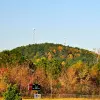
Mississippi: Woodall Mountain
34.788, -88.242
|
|

Louisiana: Driskill Mountain
32.425, -92.898
|
|

Delaware: Near the Ebright Azimuth
39.836, -75.519
|
|

District of Columbia: Fort Reno
38.952, -77.076
|
|

Florida: Britton Hill
30.986, -86.282
|
|

United States Minor Outlying Islands: Unnamed point on Navassa Island
18.396, -75.011
|
Description
This map shows the highest point in each United States state, federal district, and territory.
The highest point overall is Denali in Alaska and the "lowest highest" point is an unnamed point on Navassa Island, which is part of the United States Minor Outlying Islands. In the lower 48, the highest point is Mount Whitney in California's Sierra Nevada range and "lowest highest" point is Britton Hill in the Florida panhandle.
The highest point overall is Denali in Alaska and the "lowest highest" point is an unnamed point on Navassa Island, which is part of the United States Minor Outlying Islands. In the lower 48, the highest point is Mount Whitney in California's Sierra Nevada range and "lowest highest" point is Britton Hill in the Florida panhandle.
Data Sources